Background information on Byron Shire's climate and geography to give a context for the Master Plan.
Byron Shire is approximately 200 kilometres south of Brisbane and some 800 kilometres north of Sydney.
The Shire is renowned for its lush, green, rolling hills fringed by white sand beaches stretching virtually the length of the coastal fringe. Rainforest remnants dot the hinterland.
The two major rivers, the Brunswick and the Wilson, provide inland water systems for fishing and boating and add to the area's scenic attraction. The Brunswick River mouth is located at Brunswick Heads flowing west to Mullumbimby and Main Arm. Both the Wilson and Brunswick rivers flood in times of heavy rain, as do many of the minor streams and tributaries. Those areas most affected are Wilsons Creek with ten level creek crossings, and Main Arm with approximately 1 5 creek crossings. Upper Wilsons Creek, Upper Main Arm, Huonbrook and The Pocket can be isolated in times of flood.
National Park escarpment provides a dramatic backdrop to the northern part of the area. The southern half is characterised by rolling green hills with rich red volcanic soil, which is abundant with plant growth.
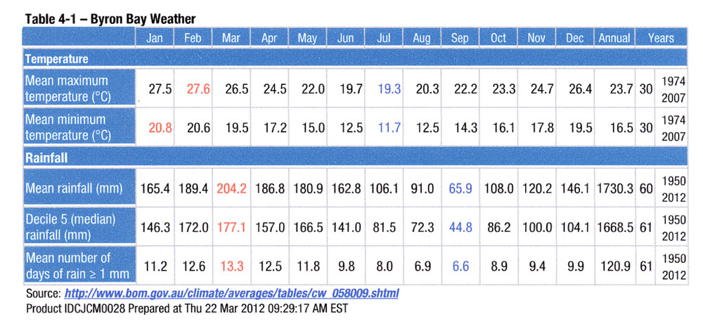
The climate is pleasantly subtropical with summer-dominated rainfall averaging 2000mm per year. This is the highest rainfall of any area in the state. Cooling ocean breezes along the coastal fringe moderates summer temperatures. Warm, mild winters are characteristic of the area. Some inland valleys experience light frosts in winter but generally the area is frost-free. The climate contributes to the area's popularity amongst visitors and locals alike generally all year round. These environmental conditions, combined with volcanic soil, means the area is alive with abundant plant growth.
The following table was sourced from the Bureau of Meteorology website for Byron Bay (or Cape Byron where the weather station is located). The averages are based on the number of years since data has been available as shown in the 'years' column.